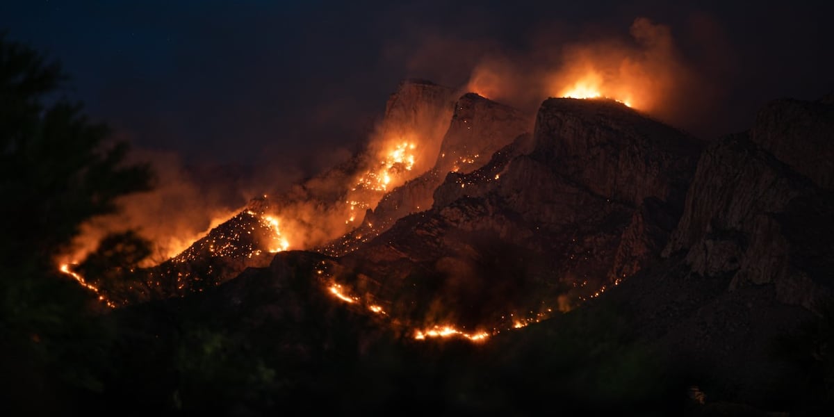
Restoration Urgently Advances Six Years After Massive Bighorn Fire
Nearly six years after the Bighorn Fire engulfed 120,000 acres of the Catalina Mountains, forest officials are urgently scaling up restoration work to battle lingering erosion and flood risks. The wildfire’s destructive aftermath continues to threaten local ecosystems and communities, with damage to soil and vegetation creating dangerous conditions that could worsen with each storm.
Edgar Martinez, watershed manager and hydrologist for Coronado National Forest, emphasized the severity of the post-fire landscape. “There was extensive damage not just to trees but also to the soil itself,” Martinez explained. The loss of vegetation means soil no longer stays anchored, increasing the chances of landslides, debris flows, and flash floods.
Immediate Threat from Flooding and Erosion Still Looms
During the Bighorn Fire, a powerful monsoon storm triggered significant flooding in the CDO Wash, washing debris and sediment down from the burned slopes. This event underscored how the fire’s impact extends far beyond the flames — unchecked erosion and unstable terrain remain a critical problem today.
“Because there was less vegetation to hold onto the soil,” Sarah Truebe, conservation manager for Sky Island Alliance, said, “the risk of soil being washed away quickly rose, which made the land vulnerable to ongoing damage.”
To tackle these hazards, restoration teams have been installing loose rock structures in key areas designed to retain soil and slow erosion. These structures work alongside natural recovery as fallen trees begin to form their own protective barriers against further erosion.
Scaling Up Restoration as the Recovery Enters New Phase
Marking the milestone of six years since the fire, Martinez says the team is ready to undertake larger-scale projects focused on the most vulnerable high-ground areas in the Catalina Mountains. “Now that we’ve passed the five-year mark, we can start thinking about bigger restoration work that could make a lasting difference,” he said.
Despite steady progress, Martinez and Truebe stress the urgent need for continued funding and volunteers to maintain momentum. The restoration work demands ongoing attention to prevent the risk of future flooding and ecosystem degradation.
This push to heal burned landscapes carries wider implications for wildfire management and watershed health across the western United States. As climate change intensifies wildfire seasons, models developed here in Arizona’s Catalinas inform how other regions, including Alaska’s wildfire zones, might approach post-fire recovery and erosion control moving forward.
What’s Next?
Forest Service and allied conservation groups will continue to monitor the evolving condition of affected watersheds. Their focus remains on installing erosion controls, restoring native vegetation, and preparing for upcoming monsoon storms that could test the resilience of the recovering terrain.
Communities near the Catalina Mountains and similar wildfire-prone areas nationwide are urged to stay informed about ongoing restoration efforts that directly impact flood and debris flow risks.
“We are gradually recovering from the incision caused by the fire across the Catalinas, but sustained effort is critical,” said Truebe.
For Alaskans and Americans living in wildfire-affected regions, these restoration advances highlight the importance of early and persistent action to rebuild damaged landscapes before the next disaster strikes.