UPDATE: Severe weather is currently wreaking havoc in New Orleans and surrounding areas, with the National Weather Service (NWS) issuing multiple alerts including a tornado watch and flash flood warnings. These alerts are in effect for several parishes in Southeast Louisiana and Southern Mississippi, as dangerous thunderstorms threaten daily life.
As of this morning, heavy rainfall has already produced between 0.5 inches and 0.75 inches of new precipitation, with forecasts predicting more rainfall throughout the day. The NWS has issued a tornado watch until noon CDT for nine parishes in Louisiana, including Jefferson, Orleans, and St. Tammany, alongside Hancock and Harrison counties in Mississippi.
Residents are advised to stay alert, as forecasters anticipate additional showers and thunderstorms after 4 p.m. today. A Special Weather Statement warns of a strong thunderstorm over Timberlane capable of producing funnel clouds and wind gusts exceeding 40 mph. This particular storm is moving northeast at 35 mph, putting communities including Chalmette and Marrero at risk.
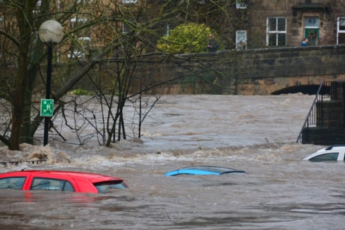
The situation has escalated into flash flooding, particularly in small creeks, streams, and urban areas. The NWS cautions that flooding on streets, highways, and low-lying areas is imminent, urging motorists to steer clear of flooded roads. A broader Flood Warning remains in effect until 10 a.m. CDT, highlighting the danger of overflowing rivers and drainage systems.
Additionally, a Flood Advisory warns of minor flooding in low-lying areas, with forecasts suggesting an extra 1 to 2 inches of rainfall could exacerbate the situation. Authorities are stressing the need for caution as flood risks remain high across the New Orleans area and its neighboring communities.
Residents are advised to keep updated through local news sources and heed the warnings from officials. The potential for severe weather conditions continues to loom, creating a critical situation for thousands in the region. Stay tuned for the latest developments as this story unfolds.