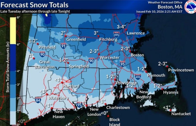
URGENT UPDATE: A fast-moving storm is poised to bring 1 to 2 inches of snow to Rhode Island this afternoon and evening, according to the National Weather Service. The snowfall is expected to start on February 10, 2023, with the northern two-thirds of the state being the most affected.
While this storm won’t deliver significant accumulation, parts of nearby Massachusetts could see 3 to 4 inches of snow. In Rhode Island, the southern areas are likely to experience a mix of rain and less than an inch of snow, adding to the already significant snowpack across the state.
The weather is particularly impactful given the ongoing cold conditions. Rhode Island has received over 20 inches of snow in January and an additional 2.6 inches so far in February, leaving the Providence area with approximately 10 inches of snow still on the ground. This persistent cold weather has hindered any thawing, with February currently averaging 19.9 degrees—a staggering 10.5 degrees below normal.
As the storm moves in today, temperatures are expected to rise slightly, reaching a high of 34 degrees in Providence. Forecasters anticipate that highs will remain between 35 and 36 degrees through Saturday, signaling a potential easing of the extreme cold conditions that have gripped the region.
Residents should remain vigilant as meteorologists are already eyeing another potential coastal storm for this weekend. With conditions rapidly changing, it’s crucial for everyone in the area to stay updated on the latest forecasts and prepare for possible impacts.
Stay tuned for further updates as this story develops, and ensure you share this important information with friends and family to keep everyone informed!