Researchers from the National Autonomous University of Mexico (UNAM) have unveiled the first three-dimensional image of the interior of the Popocatepetl volcano, one of the world’s most active volcanoes. This groundbreaking development offers vital insights into magma accumulation and volcanic activity, contributing to improved disaster preparedness for the millions who live in the surrounding areas.
Located in central Mexico, Popocatepetl, affectionately known as “El Popo,” is a significant threat to approximately 25 million people living within a 100-kilometer radius. The volcano has been under continuous observation since its last major eruption in 1994, with its activity regularly releasing smoke, gas, and ash. The implications of an eruption could be catastrophic, affecting urban centers, schools, hospitals, and critical infrastructure, including five airports.
The research team, led by geophysicist Marco Calo, has made significant strides in understanding the volcano’s complex structure. Previous studies provided limited images that failed to accurately capture the intricate details of the magma chambers. To overcome this, Calo’s team expanded the number of seismographs used in the study from 12 to 22, dramatically enhancing the collection of seismic data.
Innovative Techniques Uncover Volcanic Secrets
These seismographs measure ground vibrations up to 100 times per second. The data collected were analyzed by doctoral student Karina Bernal, who employed artificial intelligence to refine algorithms for identifying and categorizing seismic signals. This meticulous approach allowed the team to infer the materials, states, temperatures, and depths of different components within the volcano.
The resulting three-dimensional image extends 11 miles below the crater, showcasing multiple magma pools at varying depths. This advanced visualization provides a far more detailed representation than traditional models, enhancing scientists’ understanding of Popocatepetl’s behavior and aiding in forecasting potential eruptions.
Calo emphasized the volcano’s dynamic nature, noting its formation over the past 20,000 years and its continued activity since 1994. The volcano’s eruptions lead to dome formation and other geological changes, making ongoing research essential for public safety.
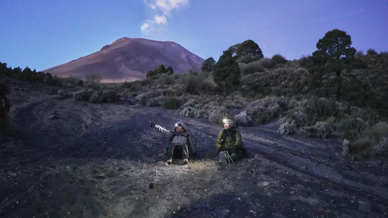
During a recent expedition, the team camped at an elevation of 12,500 feet, providing a strategic vantage point for observation. The area offers a captivating view of nearby mountains, including Pico de Orizaba and Iztaccíhuatl. At night, the sounds of the volcano resonate through the environment, with phenomena such as earth tremors and ash falling likened to rain during periods of heightened activity.
Enhancing Disaster Preparedness
Calo’s commitment to hands-on experience in the field underscores the importance of direct observation in understanding volcanic behavior. The internal mapping achieved through this research is critical for understanding potential hazards and enhancing the safety of local residents.
The detailed analysis not only aids in predicting eruptions but also significantly contributes to disaster preparedness efforts. By understanding the internal environment and composition of Popocatepetl, authorities can better inform and protect the millions who might be affected by its eruptions. As researchers continue to explore this volatile landscape, the hope is to mitigate risks and enhance safety for the communities living in the shadow of this mighty volcano.