The remarkable navigation skills of Pacific voyagers have come into focus as researchers explore how these mariners have historically traversed vast oceanic distances without the aid of modern technology. This exploration highlights the deep environmental knowledge that allows them to navigate accurately across the Pacific Ocean.
In the 1970s, anthropological research led by Richard Feinberg revealed the intricate skills of navigators from islands like Anuta in the Solomon Islands. Anuta, just half a mile in diameter and located 75 miles from its nearest inhabited neighbor, remains one of the few communities where traditional outrigger canoe travel is still practiced. Feinberg’s experiences during a bird-hunting expedition to the uninhabited island of Patutaka showcased the extensive knowledge required for such voyages, which often last for hours or even days.
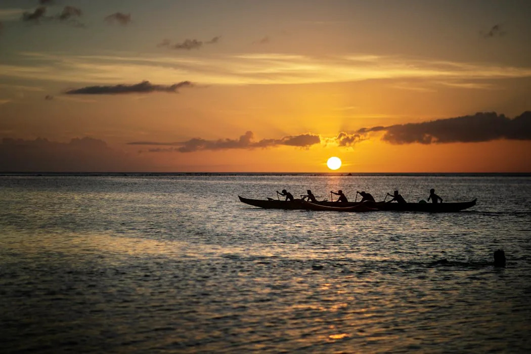
The methods of Pacific voyaging are varied and dependent on geographic and environmental conditions. Mariners employ techniques that include mental mapping of their navigational universe, using the movement of stars, ocean currents, winds, and waves to reach their destinations safely. These practices have caught the attention of Western audiences in recent years, with films like Disney’s “Moana” bringing a modern spotlight to the ancient art of Polynesian navigation.
The European fascination with Pacific navigation dates back centuries. Notably, in 1768, French explorer Louis Antoine de Bougainville referred to Samoa as the “Navigators’ Islands.” British sea captain James Cook praised the speed and agility of Indigenous canoes, inviting navigational expert Tupaia aboard his ship to document his extensive geographic knowledge.
The academic discourse around Pacific voyaging gained momentum with the publication of several pivotal works. In 1938, Māori scholar Te Rangi Hīroa, also known as Sir Peter Buck, published “Vikings of the Sunrise,” which outlined Pacific exploration as depicted in Polynesian legend. Later, in 1947, Norwegian explorer Thor Heyerdahl crossed from Peru to the Tuamotu Islands on a balsa wood raft named Kon-Tiki, sparking interest in experimental voyaging.
In 1976, the Polynesian Voyaging Society constructed the double-hull canoe Hōkūle‘a, which was designed in accordance with traditional practices but built with modern materials. Under the guidance of Micronesian navigator Mau Piailug, the vessel completed a journey of over 2,500 miles from Hawai‘i to Tahiti without the use of instruments. This voyage demonstrated the viability of traditional techniques in modern times, culminating in a global circumnavigation in 2017.
One of the key methods used by Pacific navigators is celestial navigation, relying on the positions of stars. As stars rise in the east and set in the west, navigators align their vessels with these celestial bodies. However, this method requires a comprehensive understanding of astronomy, as the visibility of stars changes with the seasons. Navigators must also consider the effects of ocean currents and wind, adjusting their course accordingly.
During the day, when stars are not visible, navigators turn to the Sun for guidance, using its position to determine their heading. In cases where both celestial bodies are obscured, voyagers rely on a variety of natural indicators, such as swells—waves generated by distant winds that maintain their direction. These swells provide critical clues to the helmsman about the proper heading, even under challenging conditions.
As voyagers approach their destination, they must identify the island’s location. Reflective waves, which bounce back from the island, serve as a key indicator. Additionally, certain bird species, known to nest on land and forage at sea, help navigators infer their proximity to land. Observing the color of the sky above a not-yet-visible island or clouds forming over volcanic peaks can also provide vital clues.
Estimating one’s position at sea presents its own challenges. While stars help determine latitude, calculating longitude often involves dead reckoning, where navigators track their starting point, direction, speed, and time spent at sea. Some Micronesian navigators utilize a technique called etak, which involves visualizing the canoe as stationary while considering the movement of a reference island.
For generations, Pacific voyagers have adeptly relied on these sophisticated navigation techniques to traverse thousands of islands scattered across the Pacific. Their remarkable knowledge, passed down through oral traditions, highlights the importance of Indigenous practices in understanding our world’s history and geography.
This article draws on insights from Richard Feinberg, who has been involved in research supported by organizations such as the National Science Foundation and Kent State University. His work, and that of many others, has contributed significantly to the field of anthropology and the understanding of Pacific navigation.