A powerful atmospheric river is set to impact Southern California, bringing several inches of rainfall that could disrupt travel on Christmas Eve and Christmas Day. The storm, expected to arrive on December 22, 2025, will intensify overnight, with the heaviest rainfall projected from Tuesday evening into Wednesday, according to meteorologists from the National Weather Service (NWS).
The NWS has issued a flood watch effective from 16:00 on December 22 until 22:00 on December 23. As noted by meteorologist Rich Thompson, this storm represents the first significant pulse of the atmospheric river.
Residents can expect between 4 to 8 inches of rain across Los Angeles County, particularly in coastal and valley areas. In Orange County and the Inland Empire, rainfall could exceed 4 inches by the end of Wednesday. The mountains in Los Angeles County may see rainfall totals ranging from 6 to 12 inches, while those in Orange County and the Inland Empire are forecasted to receive between 5 to 9 inches.
Potential Hazards and Emergency Preparations
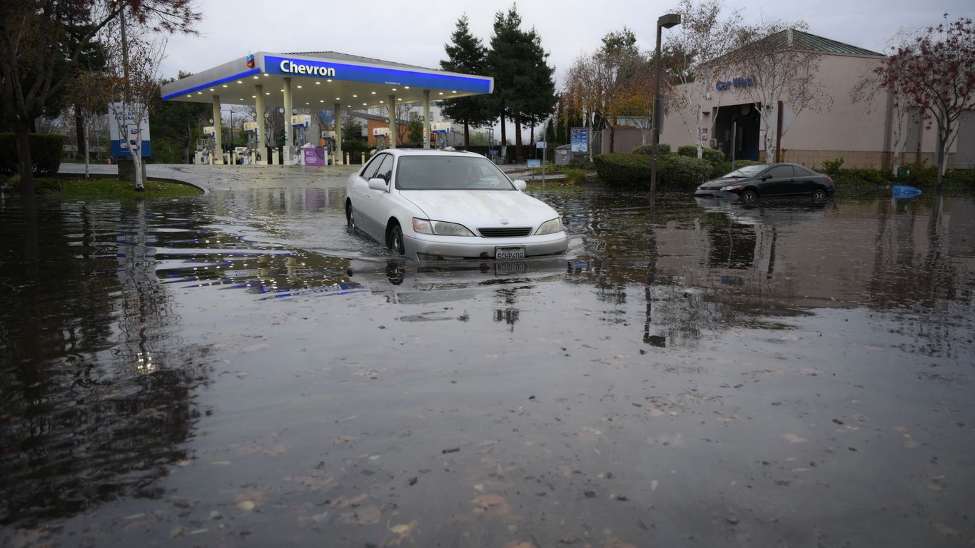
Forecasters warn of the potential for mudslides and debris flows, especially in areas affected by recent wildfires. “The LA River won’t overflow, but we anticipate significant flow, which could lead to swift water rescue situations,” Thompson said. The storm’s primary impact is expected on Christmas Eve, with urban flooding likely in low-lying areas.
As a precaution, the Los Angeles Emergency Operations Center activated on December 22 to coordinate responses to the storm. City officials are deploying resources to address issues related to swift water rescues and mudflows, focusing efforts on high-risk burn scar areas.
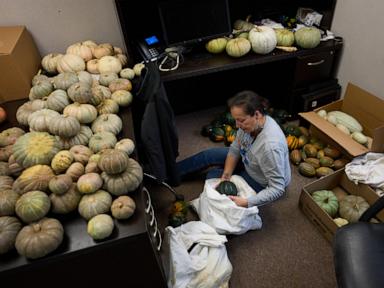
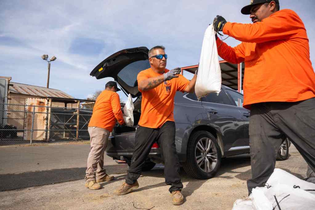
In anticipation of the inclement weather, the Los Angeles Homeless Services Authority has begun outreach efforts to inform vulnerable populations about safety precautions and available supplies. In Pasadena, residents near the Eaton fire burn scars can collect sandbags at designated fire department stations from 08:00 to 17:00.
Community Guidance and Ongoing Monitoring
Residents are advised to prepare for possible evacuations by creating emergency go bags and installing protective barriers to mitigate flooding. Clearing debris from gutters and downspouts is also recommended to enhance water flow.
Captain David Danzig of the Los Angeles County Fire Department emphasized the importance of monitoring weather conditions. “Our primary concern is the burn scar areas from recent wildfires,” he stated, encouraging the use of sandbags and caution around moving water.
In San Bernardino County, preparations are underway as officials keep a close watch on areas affected by burn scars from the Line and Bridge fires. Spokesman Christopher Prater highlighted the need for vigilance in these regions.
As the storm approaches, residents across Southern California should remain informed and heed the advice of local emergency officials to navigate potential hazards safely.