Strong Storms and Heavy Rain Expected Tonight Across Southern US
Strong to potentially severe storms are developing tonight along and south of the I-20 corridor, bringing renewed threats of large hail and damaging winds. The latest from CBS 42 Weather confirms a Marginal Risk (Level 1/5) for severe weather as a cold front moves slowly south, while an upper-level disturbance sweeps west to east along the front.
This developing weather system could produce significant downpours, with many areas forecasted to pick up 2–3 inches of rain by morning. This rainfall is expected to provide some much-needed drought relief after recent dry spell conditions.
What to Expect Over the Next Few Days
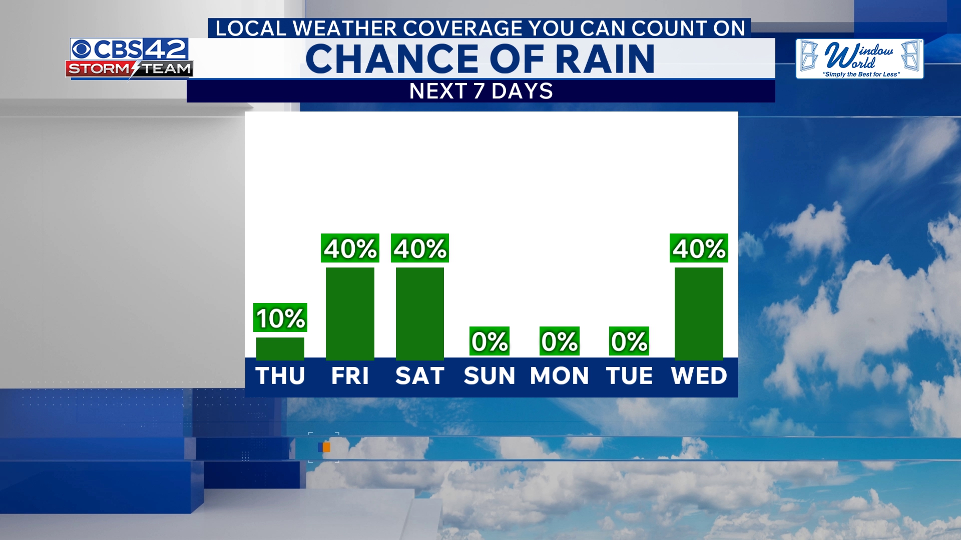
Despite tonight’s showers and storms, Thursday will be drier with rain tapering off as the cold front pushes towards the Gulf Coast. Expect partly cloudy skies and cooler temperatures with highs in the mid-70s. Lows tonight will range from the lower to mid-50s.
Looking ahead to Friday, a new area of low pressure will track along the stalled coastal boundary, triggering scattered showers and a few non-severe thunderstorms. Temperatures will drop into the upper 60s with persistent wet weather expected Friday night into Saturday morning. Overnight lows will cool into the upper 40s to near 50 degrees.
Showers may linger into Saturday morning, but gradual clearing is anticipated in the afternoon with continued cool highs in the upper 60s. Saturday night will turn mostly clear and colder, with lows dipping into the 40s. Sunday is forecasted to be dry and sunny, offering a break with highs once again in the upper 60s.
Immediate Impact and Why It Matters
The sleepless progression of storms poses a threat for localized severe weather, including large hail and damaging winds, especially for areas south of I-20. The heavy rainfall, however, is a vital boost for drought-affected regions, partially replenishing dry soils and reservoirs.
Residents should stay alert to changing weather conditions tonight and Friday, with a particular focus on roadside visibility and potential localized flooding in low-lying areas. Although severe risk remains low, vigilance is essential as storms develop.
“Tonight’s storms bring a marginal risk for severe weather, mainly large hail and damaging winds,” says CBS 42 Weather forecasters.
Stay Prepared for Evolving Weather in Coming Days
As this cold front slowly shifts and the coastal boundary stalls, residents across the affected region should monitor updates closely. The rain and storm threat will persist through the weekend before improving conditions return on Sunday.
This weather pattern, while less intense than past severe outbreaks, underscores the ongoing volatility in spring weather across the southern United States, where sudden storms can disrupt daily life and travel.
The Alaska Insider encourages readers to remain informed as this system unfolds and share alerts with friends and family to ensure safety amid these developing conditions.